File:Palestine location map wide.png
Jump to navigation
Jump to search


Size of this preview: 322 × 598 pixels. Other resolutions: 129 × 240 pixels | 614 × 1,141 pixels.
Original file (614 × 1,141 pixels, file size: 103 KB, MIME type: image/png)
| This is a file from the Wikimedia Commons. Information from its description page there is shown below. Commons is a freely licensed media file repository. You can help. |
Summary
| Description |
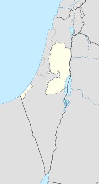
English: West Bank area with wider view for better perspective. longitude 33.7 to 36.3 and latitude 33.5 to 29.3. Change in fill colour only. |
| Source | File:Israel location map.svg |
| Author | NordNordWest |
Licensing
|
This file is licensed under the Creative Commons Attribution-Share Alike 3.0 Unported license. | |
|
File history
Click on a date/time to view the file as it appeared at that time.
| Date/Time | Thumbnail | Dimensions | User | Comment | |
|---|---|---|---|---|---|
| current | 08:33, 16 July 2014 | | 614 × 1,141 (103 KB) | Enoough kept | {{Information |Description ={{en|1=Palestine area with wider area for better perspective. longitude 33.7 to 36.3 and latitude 33.5 to 29.3. Change in fill colour only.}} |Source =File:Israel location map.svg |Author =NordNordWest |Da... |
File usage
More than 100 pages use this file. The following list shows the first 100 pages that use this file only. A full list is available.
- Abasan al-Kabira
- Abasan al-Saghira
- Aboud
- Abu Dis
- Ad-Dhahiriya
- Aida Camp
- Al-Bireh
- Al-Eizariya
- Al-Jiftlik
- Al-Khader
- Al-Mawasi
- Al-Walaja
- Al Jib
- Alexandrium
- Anzah
- Aqabah
- Arraba, Jenin
- As-Samu
- Ash-Shuyukh
- Askar (camp)
- Balata
- Bani Na'im
- Bani Suheila
- Battir
- Battle of Yarmouk
- Beit Hanina
- Beit Hanoun
- Beit Jala
- Beit Lahia
- Beit Lid
- Beit Sahour
- Beit Ur al-Tahta
- Bethlehem
- Bil'in
- Birzeit
- Bureij
- Cave of the Patriarchs massacre
- Deir Ballut
- Deir Dibwan
- Deir al-Balah
- Deir al-Balah Camp
- Dheisheh
- Ein Yabrud
- Eli, Mateh Binyamin
- Fandaqumiya
- Faqqua
- Gaza City
- Hajjah, Qalqilya
- Halhul
- Har Brakha
- Hebron
- Herodium
- Hisham's Palace
- Hizma
- Husan
- Huwara
- Iktaba
- Immatain
- Jabalia
- Jayyous
- Jenin
- Jericho
- Kafr Abbush
- Kafr Jammal
- Kalandia
- Khan Yunis
- Kifl Haris
- Maghazi (camp)
- Mount Ebal
- Mount Gerizim
- Naaran
- Nablus
- Nahalin
- Nili, Mateh Binyamin
- Ofra
- Qabatiya
- Qalqilya
- Qibya
- Qumran
- Rafah
- Rafah Camp
- Rafat, Jerusalem
- Ramallah
- Rehelim
- Salfit
- Sebastia, Nablus
- Shalom Al Yisrael Synagogue
- Shuqba
- Silwad
- Surif
- Taybeh
- Timnath-heres
- Tubas
- Tulkarm
- Tuqu'
- Turmus Ayya
- Umm ar-Rihan
- Ya'bad
- Yatta, Hebron
- Zababdeh
Global file usage
The following other wikis use this file:
- Usage on af.wikipedia.org
- Usage on ar.wikipedia.org
- Usage on ast.wikipedia.org
- Usage on bn.wikipedia.org
- Usage on br.wikipedia.org
- Usage on bs.wikipedia.org
- Usage on cdo.wikipedia.org
- Usage on ceb.wikipedia.org
- Usage on el.wikipedia.org
- Usage on es.wikipedia.org
- Usage on fa.wikipedia.org
- Usage on fi.wikipedia.org
View more global usage of this file.